
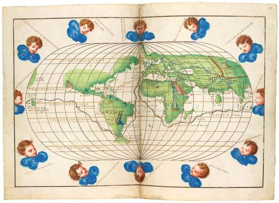
Portolan Atlas, on vellum
Opening: Map of the World with Magellan's Route
Purchased by Pierpont Morgan, 1912
Between 1536 and 1564, the heyday of Italian mapmaking, the cartographer Battista Agnese produced in Venice a number of remarkably accurate and beautifully decorated nautical or "portolan" atlases. About seventy copies are known to exist today. A luxury item, the atlas was unlikely to have been used in practical navigation and was reserved for rich merchants and high-ranking officials.
The map with twelve wind cherubs traces Ferdinand Magellan's sea route for his near circumnavigation of the world (he died before completing it) in 1519–22 along with a route from Spain to Peru. The oval depiction of the world represented a new type of map introduced by Benedetto Bordone's Isolario (Book of Islands).